In 1979, an artist named Christopher Cross wrote and recorded a song called ‘Sailing’. Highly popular, it won the prestigious ‘Song of the Year’ category at Grammy Awards in 1981.
A soft rock song, it sang of the joy, tranquility, and freedom found while sailing. Let’s explore this serene hobby in more detail, in particular, what it means to sail pilotage and the importance of passage planning.
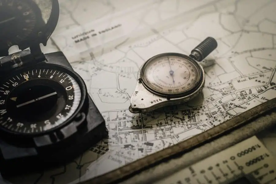
Right now you may be wondering to yourself, “what is pilotage in reference to sailing?” Piloting (or pilotage) is navigating by eye, compass, and chart, using fixed points of reference, to determine a vessel’s location.
It is the skill of recognizing where you are by reading a map and comparing it with the surrounding landscape.
Pilotage aims to determine a series of ‘safe tracks’ (without plotting a position on a chart), confirming at any time that the vessel is on (or close to) these tracks.
Marine pilotage is used when entering or leaving a harbor, when time does not allow for fixed-point plotting on a chart and where an error of just a few boat lengths can have grave consequences.
What You Need for Safe Pilotage and Passage Planning
Navigating pilotage is actually quite simple. In local waters, pilotage is done with little conscious effort as a sailor is very familiar with the buoys and landmarks that point out one’s position.
However, in strange waters, it is crucial to creating an easy pilotage plan by combining information available from pilot books, sailing charts, and nautical almanacs.
Pilotage should be assembled in a clear and concise manner. Do not write information in essay format but rather illustrate in pictorial form. This is simple to do and easier to understand.
The key to pilotage is planning ahead. You will need the following:
- Pilot books (also known as ‘sailing directions’ or ASD’s)
- Sailing charts (up-to-date and informatively correct)
- Nautical Almanac (Reed’s Nautical Almanac, for example, for the current year)
A passage plan is a way of navigating (from berth to berth) to ensure a safe voyage by:
- Acknowledging possible hazards and assessing associated risks
- Monitoring water depth/sufficient sea room
- Choosing the best course according to the appropriate position
- Reporting any and all necessary requirements and taking routing measures
- Acting responsibly and respectfully towards other vessels
- Being aware of current and changing weather conditions
- Following all pertinent safety measures
Pilot Books
Pilot books contain information that will help you decide, for example, which approach channel to use if there is more than one option.
One channel may be preferable to another if the wind is coming in at a certain angle or when the tide is setting in a particular direction.
Not all channels are marked with lit buoys at night or have sufficient water depth at low tide. Subsequently, these channels can only be navigated safely with local knowledge.
The British Admiralty publishes pilot books covering the majority of the world. BA Pilots are primarily intended for commercial use by shipping vessels, however in recent years, have included information on small boat navigation as well.
Cruising clubs will also produce pilot books and sailing instructions for local areas. An example of this would the Florida Cruising Directory which contains instructions on how to properly navigate the marinas and other areas off the coast.
The National Ocean Service (NOS) publishes a series of excellent United States Coast pilot books covering the United States coastal waters at around $25 each (2018/2019 editions), according to MDNAUTICAL.COM The nine pilot books are available as follows:
- Coast Pilot 1 – Atlantic Coast: Eastport, ME to Cape Cod, MA
- Coast Pilot 2 – Atlantic Coast: Cape Cod, MA to Sandy Hook, NJ
- Coast Pilot 3 – Atlantic Coast: Sandy Hook, NJ to Cape Henry, VA
- Coast Pilot 4 – Atlantic Coast: Cap Henry, VA to Key West, FL
- Coast Pilot 5 – Gulf of Mexico, Puerto Rico, and the Virgin Islands
- Coast Pilot 6 – Great Lakes and the Connecting Waterways
- Coast Pilot 7 – Pacific Coast: California, Oregon, Washington, Hawaii, and Pacific Islands
- Coast Pilot 8 – Alaska: Dixon Entrance to Cape Spencer
- Coast Pilot 9 – Pacific and Arctic Coasts, Alaska: Cape Spencer to the Beaufort Sea
Sailing Directions
Sailing directions, both ‘Planning’ and ‘Enroute’ is published by The Defense Mapping Agency and contains pertinent information on harbors, coasts, and waters around the world.
Sailing directions are published in written form and gives detailed information on port approaches and the general coastline. It also contains some sketches, small charts, and photographs. Let’s explore these in more detail below.
Planning Guides
Planning guides assist a sailor in preparing for an extensive oceanic voyage. They also provide vital information on individual countries and all ports applicable to those countries.
Each volume consists of a pre-determined area by covers an arbitrary division of the world seas.
Individual planning guides are divided into countries and ocean basins as follows:
- Pub. 120 – fifty-one countries and one ocean basin (Pacific Ocean)
- Pub. 140 – eighty-seven countries and six ocean basins (Baltic Sea, Black Sea, Caribbean Sea, Mediterranean Sea, North Atlantic Ocean, and the North Sea/English Channel)
- Pub. 160 – sixty-one countries and three ocean basins (Indian Ocean, South Atlantic Ocean, and the Red Sea/Persian Gulf)
- Pub. 180 – five countries and one ocean basin (Arctic Ocean)
Information on specific countries in each volume includes the following:
- Buoyage systems
- Currency
- Government
- Holidays
- Fishing zones
- Firing areas
- Mining areas
- Languages
- Popular industries
- Navigational information
- Pilotage information
- Offshore drilling
- Prohibited areas
- Pollutions issues
- Search and rescue operations
- Time zones
- Submarine operating areas
- Regulations
- Signals
- Traffic separation schematics
- Vessel traffic systems
- U.S. embassy
Ocean basin information included in each volume outlines the following:
- Climatology
- Currents
- Fishing zones
- Geophysical features
- Magnetic fields
- Ionospheric disturbance
- Meteorology
- Mining areas
- Navigational information
- Optical illusion phenomena
- Pilotage information
- Pollution
- Routes
- Seas
- Tides
- Regulations
- Surface temperature
- Ice areas
- Ship reporting systems
Enroute Guides
Enroute guides contain numbered regions along a coast or through a strait. Each region is reviewed in turn.
It also contains a preface with detailed information about authorities, treaties, and references for each coastal area.
A table showing conversions between feet, fathoms, and meters is also included. Each volume also provides a list of commonly used abbreviations for the various terms used in the text.
The first items shown are chart information graphics, which depict digital nautical charts (DNC) pertaining to each region.
The sequence of the chartlets enables navigators to locate the largest scale chart for a location as well as find a specific feature listed in the index-gazetteer.
A glossary of foreign terms and a complete index-gazetteer follows the regional descriptions. The index-gazetteer is an alphabetical listing of described and charted features present in the Enroute guide. It lists each feature by its geographical coordinates and sector-paragraph number.
A majority of nations publish sailing directions for their local waters. The most commonly used is the United Kingdom Hydrographic Office’s ‘Admiralty Sailing Directions’ or ASD’s.
These provide the most detailed geographic coverage of coastal routes around the world. They are designed to supplement the data found on British Admiralty Nautical Charts.
By outlining routes for seagoing vessels, relative to coastal features, ASD’s are essential for sailing pilotage.
The Admiralty book entitled ‘Ocean Passage for the World’ is also helpful as it outlines offshore routes for power-driven vessels and low-powered sailing boats separately. ASD’s are also commonly used by naval and government vessels.
Nautical Almanacs
There are many nautical almanacs available today. These range from the small, inexpensive, local versions to the well-known Reed’s Nautical Almanac. Let’s explore these pilotage necessities in more detail below.
Local nautical almanacs usually consist of tide tables and briefly outlined items of general interest. Reed’s, however, is one of the best almanacs on the market today and contains many pages of valuable information.
Reed’s publishes almanacs for the majority of ports in the United States, from the East coast to the West coast and also the Caribbean.
Common details found in Reed’s Nautical Almanac includes navigation and general information such as shelter areas, landmarks, VHF radio channels, telephone numbers, town facilities, fuel availability, etc.
Also included are tidal height data, current tables for reference ports, and subordinate station differences for most areas outlined in the almanac.
The 2019 version of Reed’s Nautical Almanac in paperback form is great. Almanacs must be replaced each year to be sure the information included is up-to-date.
Reed’s will also issue corrections each year, which are mailed out, free of charge upon request. It is recommended that you submit the corrections request form immediately and once received, keep it handy with your almanac.
Eldridge Tide and Pilot Book covers tides and currents from Nova Scotia to Key West on the East Coast and is often referred to as ‘the mariner’s bible’.
It includes useful information on GPS and electronic navigation, marine weather patterns, Federal regulations, navigation rules, coastal pilotage tips, and emergency first aid instructions. In addition, it provides interesting articles on fishing, nautical astronomy, and maritime traditions.
The 2019 version is available through Amazon in paperback form. It is a valuable resource at a reasonable price but does not, however, include harbor entrance charts.
As mentioned earlier, almanacs must be replaced every year. Eldridge, like Reed’s, will also mail a supplement to you upon request, listing changes to lights, buoys, fog signals, etc.
Planning a Passage
It is important to plan a passage ahead of time. If you are planning the pilotage for entry to a harbor that has a channel marked with buoys, using a pilot book as well as sailing charts will help you achieve this.
An example of how to do this is outlined below:
- Choose the best channel to use, based on the pilot books, if indeed there is a choice.
- Decide on a definite starting point (such as a cardinal mark or buoy) at the beginning of the channel.
- Draw the planned route on the chart from start to finish. Note that this will include a number of different tracks rather than a single straight line.
- Draw the tracks in a way that clearly shows any turning points represented by a cardinal mark or buoy.
- Make sure that you have utilized any and all marks that could be potentially useful.
- If you are passing through an area requiring you to pilot without stopping at a port, be sure to highlight a buoy or bearing that can be clearly defined in your completed pilotage plan.
- If tidal heights are a factor, illustrate the tidal curve beforehand and do the same for any tidal streams.
- Include any and all bearing variations and/or deviations and be sure they relate to the boat’s compass.
- Wherever possible, use suitable ranges (rather than courses) to navigate. It is easier to pilot a vessel on a precise heading (by keeping two objects inline) rather than attempting to steer a course using a compass. A boat held on a range is automatically compensating for such factors as the tide, leeway, etc.
- Try to put all this information into a pictorial form so it is easily understood and can be quickly accessed.
Note: If you are entering a harbor, be aware of any signals used by the harbor to regulate traffic and switch your VHF to the channel the harbor or marina uses.
Some of the busier ports require you to call them in advance on VHF and request permission to enter. Check the almanac for additional information.
Routine for Navigating a Vessel on a Coastal Passage
- Stick to your pilotage plan. Do not take shortcuts. The area will likely appear differently than what you envisioned in your mind. This is why you created the pilotage plan and why it is so important.
- Begin at the first mark and clearly identify it. This will ensure you that have the right one when coming to it.
- Check the identification of each mark as you pass it and check it off on your pilotage plan.
- Do not automatically assume that the mark ahead is the next one. Compare its bearing to your notes.
- As soon as you change course and are in line with the next mark, choose a fixed object or shore light directly in line with the mark and use it as a range to steer past. Note that the object does not have to be on the chart but it does have to be fixed.
- Keep a watchful eye on the depth sounder. This will identify any errors in your pilotage.
- Set the depth sounder’s shallow alarm (provided it has one) to a reasonable safety margin.
- It is better if you have someone else in charge of the helm and/or sails. This frees you up to concentrate solely on the pilotage plan.
- Make sure that your instructions to whoever is in charge of the helm are clear and concise. Do not give vague or ambiguous instructions such as “head for that light”. Instead, pick a suitable range and ensure your directions are clearly understood.
Points of Reference
Common types of visual reference points used for piloting (pilotage) include:
Day
- Natural features such as mountains, hills, cliffs, rocks, beaches, lakes, and rivers
- Navigational tools such as sea marks (buoys and beacons) and landmarks
- Other land structures such as cities, highways, airports, dams, and radio antennas
Night
- Lit-up navigational tools such as lighthouses, lighted vessels, and lighted sea marks
- Lit-up man-made structures including airports, towers, and buildings
Vertical
- A depth sounder used to measure depth as well as identify a bathymetric contour/crossing point This allows the navigator to confirm safe passage over areas of obstruction
Port Control
When approaching a harbor, it is recommended that you switch your VHF (very high frequency) to dual.
Observe the port working channel and inquire if it is mandatory to contact the port authority.
If so, then contact them and ask for permission to enter. Also, ask if they have any additional navigating instructions or recommendations.
Lock Gates and Marinas
If there are lock gates or a sill at the entrance to the harbor or marina, inquire as to whether or not you can go directly in or if you will have to wait. If you must wait, refer to the almanac on where you can ‘tie up’, moor or anchor.
If a marina is your last stop, contact them on their working channel and arrange your docking site together as well as any other directions you may need.
Be sure to also ask on which side to place your fenders to avoid the hassle of having to change them all around at the last minute.
If you need assistance at the docking site, ask the berthing master on the pontoon. Check-in with the harbor master or the marine office as soon as possible to complete any and all necessary paperwork.
Customs and Immigration – Crew and Passenger Lists
By law, it is required that all vessels clear customs and immigration upon entry into a foreign port.
This is not unlike what you would expect to do upon arrival at any international airport. Customs forms are provided at the port you are visiting by a customs officer.
It is essential that you have both your vessel’s documentation and registration upon clearing customs.
The boat master must provide Immigration with a list of all passengers and crew. The crew list must include the following information: name, nationality, passport number, and date of birth.
It is important to note that any and all fees (for both customs and immigration authorities) are usually charged in the local currency.
Be sure to plan for this in advance and have the money ready. Cruising permits may also be required in some countries. These allow you to travel legally in their territorial waters. There is usually a fee associated with this permit as well so be prepared.
Related Questions
What are some other types of charts used in navigation? Along with nautical charts, there are other forms of cartography (using natural and man-made features as points of reference appropriate to a specific type of navigation) useful in navigation. These include:
- Aeronautical charts. These are pictorial representations of the earth’s surface including terrain and other geographical features. They vary in scale from 1:1,000,000 (world aeronautical charts) all the way to 1:250,000.
- Topographic maps. These outline basic land formations, terrain, lakes, rivers, forested areas, roadways and railways, and other man-made landmarks. These use large-scale detail and contour lines to depict both natural and man-made features.
What is course tracking vs ground tracking? The line connecting reference points (or fixes) is the track over the ground (or sea bottom). The navigator compares the ground (sea bottom) track with the navigational course for a specific leg of the intended route.
This is done to a needed correction in ‘heading’ (the direction the vessel is pointed to maintain its course in the face of cross-currents of wind or water) that otherwise might carry the boat off-course.
What is a Maritime pilot and how much would one earn in wages? A maritime pilot (also known as a marine pilot, harbor pilot, or bar pilot) is a sailor who safely steers vessels through congested waters, such as harbors or river mouths.
They are navigational experts and possess in-depth knowledge and understanding of a particular waterway including its depth, currents, etc. They earn a salary ranging anywhere from $100,000 to $400,000 per year.
Conclusion
In conclusion, upon reading this article, you should now have a better understanding of how to sail pilotage and the importance of passage planning in advance.
It is necessary to use pilot books, sailing charts, and nautical almanacs when piloting a vessel in open waters. A sailor should have these resources ready before setting out on an oceanic voyage.
Upon arrival at your destination, understanding the specific docking requirements is crucial. Ports, lock gates, and marinas all have safety procedures in place that need to be followed.
There is also strict policy when dealing with customs and immigration so do your research and be prepared. The better prepared you are, the easier the disembarkation.
