
Having the ability to spot certain cloud formations while out sailing can give you a good heads up on what awaits you weather-wise.
Depending on what the current weather’s like and what you see on the horizon can mean many different things when the kinds of clouds differ.
Being a science geek, I’ve always found the meteorological aspect of sailing to be interesting because you can deduce relatively well what the weather is telling you by paying attention to the types of clouds and their patterns.
The aerodynamics of sailing and the different types of sails are also very interesting to learn about.
While there’s certainly room for error, being able to quickly spot cloud patterns and knowing the cloud pattern names that hint at future weather situations can give you a leg up in terms of your planning your course.
So what are the different types of clouds and their meanings when sailing?

Basic Cloud Types
There are three major types of clouds, or cloud formations, from which you get all the differnt cloud types (or subtypes). I.e., all variations of clouds are grounded in these three cloud types.
We’ll categorize cloud formations per these 3 categories and then expand on the rest of their characteristics to get the different subtypes. By the end of this short article, you’ll be able to pinpoint the exact types of clouds and their meaning when sailing.
Cirrus
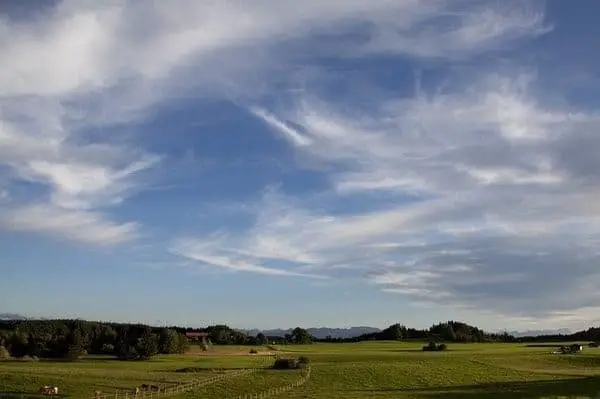
The first type of cloud we’ll look at are cirrus clouds, which are considered high-level clouds and take on a visual characteristic many are surely familiar with.
Cirrus clouds form at heights towering 20,000 feet or more above the Earth’s surface and have a thin, white look to them. Often times they looked severed or detached from one another.
The cirrus clouds are the highest clouds and thus can form ice inside of them due to the extremely cold temperatures above.
Since these clouds are essentially filled with ice crystals, they are extremely cold and the result of super cold water droplets. When you see cirrus clouds, it’ll likely indicate fair weather conditions.
Witnessing cirrus clouds can imply that you’re staring at an approaching warm front. We’ll get into what a warm (and cold) front is later on, but it’s important to understand that incoming cirrus clouds can mean a warm front is approaching.
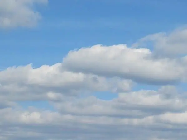
Cumulus

The second type of cloud we should talk about is the cumulus cloud, which are considered low-level clouds and is most prominent during the summer months.
Cumulus clouds don’t appear at the towering heights as a cirrus cloud and oftentimes have a more chunky, white look to them. Often times their bottoms are relatively flat while the top of a cumulus cloud takes on a cauliflower appearance.
The cumulus clouds can often be found as low as 3,000 feet and as high as 6,000 feet above the surface of the Earth, which is pretty low compared to cirrus clouds.
As a matter of fact, these clouds grow upwards towards the atmosphere and can quickly develop into thunderstorm clouds (or cumulonimbus clouds).
If you see cumulus clouds on the horizon, then the likeliness of you being approached by a warm front is very high.
While a cirrus cloud formation hints at a possible warm front, cumulus clouds can make it almost guaranteed. If you’re surrounded by cumulus clouds, be ready for a warm front to approach pretty soon.
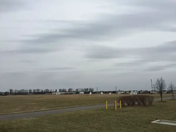
Stratus
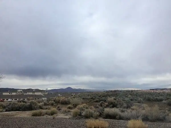
The third type of cloud to learn about is the stratus cloud. A simple stratus clouds definition would be that they are considered low-level clouds and have a foggy look to them but obviously much higher in the sky.
Stratus clouds are generally closer to the Earth’s surface similar to cumulus clouds and can cover very large areas of the sky.
Since these clouds can stretch vast distances, they appear to have a continuous form and can be thick and gray.
Similar to cumulus clouds, one of the more important stratus clouds facts is that they generally hover between 3,000 and 6,000 feet above the surface of the Earth.
Stratus clouds can look like fog that are instead high up in the sky and can produce a light mist and drizzle for us sailors below.
Stratus clouds are indicative of either a warm or cold front as the other basic types of clouds are.
However, the variations of clouds that are based on stratus clouds can provide insight into what’s exactly on the horizon in terms of potential ill weather. More to come on that shortly.
Variations of Basic Cloud Types
Now that we’ve covered the basic cloud types, including cirrus, cumulus, and stratus, we need to take a look at the number of variations they can take.
Variations of the basic cloud types can provide either subtle or glaringly obvious signals warning sailors what’s in store for them if they stick around.
Cirrostratus
Just like cirrus clouds, cirrostratus clouds are formed at very high altitudes above 20,000 feet above the Earth’s surface and are thus considered high-level clouds.
Since the cirrostratus clouds are so high up in the air, they’re made out of ice crystals due to the cold temperatures when moving toward the atmosphere.
Cirrostratus clouds have a milky white look to them and, like cirrus clouds, are often quite thin and spread out.
These clouds often times cover the entire sky kind of like the stratus clouds, but instead at a very high altitude. That’s exactly why they’re called cirrostratus clouds!
Similarly to the cirrus and cumulus clouds, witnessing cirrostratus clouds often means that a warm front is well on its way to your location.
If you’re surrounded by cirrostratus clouds, it’s likely you’ll experience some amount of rain within the next 12 to 24 hours, which is just the beginning.
Altostratus
The altostratus variation of cloud types are considered mid-level clouds and are formed at altitudes below those of cirrostratus which can cover very large portions of the sky just the same.
As a matter of fact, altostratus can be quite thin if they are at a high altitude and pretty dark and heavy if closer to the ground.
Altostratus clouds are gray or blue-gray since they are formed by ice crystals as well as water. These types of clouds can be placed anywhere between 6,000 and 20,000 feet in the air, which is getting pretty close to Earth!
Seeing altostratus clouds after having seen cirrostratus clouds indicates you have a warm front on the way that is ready to hit pretty soon.
As a matter of fact, it’s possible that rain or snow is already falling from an altostratus cloud, but they’re high enough in the sky that those drops or flakes never touch the ground or water. If they do hit the water, you don’t have altostratus clouds. You have nimbostratus clouds.
Nimbostratus

The nimbostratus variation of clouds are considered low-level clouds and are the clouds we’ve all been waiting for (if we were waiting for the warm front storm to appear).
Just like stratus clouds, nimbostratus clouds are found no more than 6,000 feet above the Earth’s surface and can encapsulate the entire sky like a huge blanket.
When you think of thunderstorms with expansive dark clouds filled in the sky, you’d be thinking exactly about nimbostratus clouds.
These clouds are dark gray and appear to have no end in sight. If you see nimbostratus clouds, you’re most definitely experiencing some level of rain or snow and have zero vision of the blue sky.
When you’re under nimbostratus clouds, you are effectively at the edge of a warm front.
Before having experienced this storm, however, you would’ve already experienced a smaller amount of rain or snow from the previous incoming altostratus clouds. Only this time, the clouds are lower, darker, and less forgiving.
Cirrocumulus

The cirrocumulus variation of clouds are considered high-level clouds and are those that are high up in the sky around the cirrus clouds, but with a different cloud pattern.
Just like cirrus clouds, they tend to hover at 20,000 feet or above and are comprised of ice crystals, and have a patchy pattern.
Cirrocumulus clouds can be identified fairly easily since they look like a bunch of white (sometimes gray), puffy clouds that patch the sky.
As a matter of fact, they look a bit like the scales on a fish which is why it’s commonly referred to as a “mackerel sky”. Cirrocumulus clouds are also some of the least common clouds to find in the sky, so if you see them take a gander for a while.
Seeing cirrocumulus clouds indicates not much more than the fact that you’re probably in the winter months and that it’s a bit on the mild outside.
Actually, they’re usually the result of cirrus or cirrostratus clouds degenerating, which potentially indicates the decreased likeliness of a warm front coming.
Altocumulus

The altocumulus variation of cloud types are considered mid-level clouds and are formed at the same level above the Earth’s surface as altostratus, which is anywhere between 6,000 and 20,000 feet.
However, unlike the altostratus clouds, altocumulus clouds are more clumped together and have more of a cotton ball appearance to them.
Altocumulus clouds often have an oval or elliptical shape and are covered in gray at the bottom of the clouds.
These types of clouds can group up at times resulting in a chain of altocumulus clouds over half a mile (1 km) thick. In the end, they’re kind of your typical-looking cloud.
If you see altocumulus clouds forming in your area, especially on a warm, humid morning, it’s quite likely that you’ll experience some thunderstorms later on in the afternoon.
Apart from that, altocumulus clouds can form ahead of a cold front especially if they’re followed by lower, darker clouds.
Stratocumulus
The stratocumulus variation of cloud types are considered low-level clouds and thus usually hover 6,000 feet or less above the Earth’s surface, similar to stratus and stratocumulus clouds.
One of the distinguishing factors for stratocumulus clouds is they often appear lumpy and gray, which are quite different from other clouds at this level.
Stratocumulus clouds are usually quite spread out and form in rows almost as if they’re connected (which they often are). If you’re around stratocumulus clouds, it’s likely you’ll be experiencing a bit of drizzle as they’re known for containing a good amount of water.
Stratocumulus clouds can definitely look like altocumulus clouds, so a good way to determine whether they’re stratocumulus is if they’re about the size of your fist when held up to the sky.
If you see stratocumulus clouds around your area, it’s not likely that there’s any front on the way. As I previously mentioned, you’ll mainly experience some light precipitation that’s on and off. You’re in the clear (sort of)!
Cumulonimbus
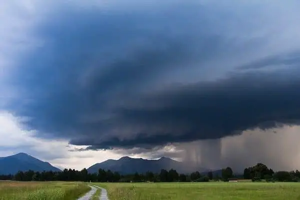
The cumulonimbus variation of cloud types are considered to be low-, mid-, and high-level clouds, which makes them more vertically developed as opposed to horizontally developed.
This makes them rather unique among the different clouds we’ve looked at so far since they can exist as low as 1,000 feet to as high as 39,000 feet or higher!
Cumulonimbus clouds are distinct in their form due to their containing a large amount of water at the bottom and ice crystals at the top.
As they reach their peak heights, the top of the cumulonimbus cloud will flatten out due to high winds resulting in an anvil-like appearance.
As you might have already assumed, they are perfect cloud candidates for bringing on heavy rains since they encapsulate the entire precipitation process.
If you see cumulonimbus clouds around your area, you’re almost guaranteed to have an explosion of bad weather conditions. These clouds are the result of an incoming cold front and are the main culprits of intense thunderstorms.
These thunderstorms can produce a lot of unfavorable conditions and can morph into what is known as supercell thunderstorms, which can produce heavy rain, snow, hail, lightning, wind, and even tornadoes.
The Two Main Types of Weather Fronts
The types of clouds and their meaning when sailing are important to understand because they’re often indicative of a particular weather front approaching wherever you’re located.
Whether you’re out on the water or preparing to set sail, being able to identify the set of clouds in the sky and deduce what they’re trying to tell you can help you out tremendously while adventuring out on the water.
I want to talk to you about the two main types of weather fronts that you’ll likely experience if you see certain cloud patterns forming, but to be fair there are four different types of weather fronts.
The ones we as sailors are most interested in are warm fronts and cold fronts, but there are also stationary fronts and occluded fronts.
A weather front simply describes the separation between two air masses.
While cloud formations will certainly point to what you should expect in terms of an incoming weather front, you can also depend on other meteorological characteristics including wind direction, wind strength, visibility, and temperature changes.
Warm Front
A warm front can be described as the edge of a warm air mass colliding and pushing away a cold air mass.
Due to the rotation of the Earth and other geographical conditions, warm fronts generally move from the southwest up through to the northeast. When a warm front rolls on through, you’ll notice that the temperature outside is generally warmer and more humid than before.
Warm fronts can be detected quite effectively by reading the cloud formations around your area.
If you see a chain of clouds that go from cirrus to cirrostratus to altostratus to nimbostratus, you’ve found yourself a warm front. Visible fog is a good initial indication that a warm front is on its way along with poor visibility and increasing rain.
Cold Front
A cold front can be described as the edge of a cold air mass colliding and pushing away a warm air mass.
Similar to warm fronts, the direction cold fronts usually travel toward is dependent on the Earth’s rotation and other geographical conditions resulting in a general move from the northwest to the southeast.
As you might suspect, an incoming cold front will bring in cold weather that’s usually quite dry.
Cold fronts can produce a big drop in temperature in a short amount of time, which is usually an indication that a cold front is afoot.
Cloud patterns aren’t as reliable when detecting cold fronts, but a good sign is slightly elevated cumulus clouds that produce rain at an increasing amount.
This can be a precursor to the potentially dangerous cumulonimbus clouds that are vertically massive and can deliver heavy thunderstorms.